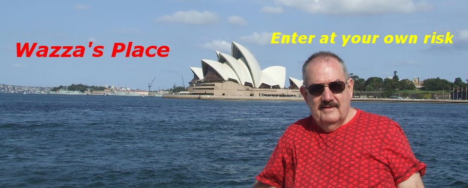
Brisbane to Perth with Holtie Part 10
From
south, but we first stopped at Busselton. Founded in 1832 by
the Bussell family, Busselton has been one of the fastest
growing regions in
population of over 20,000.

Click on any photo to enlarge.
Busselton is home to the longest wooden jetty (pier) in the
southern hemisphere, stretching almost 2 km out to sea.
Construction of the jetty began in 1853 and was continually
extended until the 1960s when it reached its current length of
1841 metres. It was closed to shipping in 1972, and
maintenance was discontinued for a time. It has since been
restored, and is now the site of an underwater observatory.

The day we stopped at Busselton to see the jetty a huge
storm blew up so we weren’t able to go onto the jetty but
decided to continue onto

than meanders just north of the town centre and flows
west to the
after Margaret Wyche, cousin of Busselton founder John Garrett Bussell.


Vineyards and grapes in the Margaret River area.
The surrounding area is known informally as the
production and tourism, attracting an estimated 500,000
visitors annually. High-quality table wine grapes have been
grown by a variety of commercial vineyards since the first
vineyards were established in the area in the late 1950s.
Although the region is one of
it produces just three percent of total Australian grape
production, while producing more than 20 percent of the
nation's premium wines.
We arrived at the caravan park in
very stormy conditions. By the time we had erected the
tent, rain had started to fall. By
could have thought night had fallen. Peter went and heated
up some food for dinner and I decided to eat my meal cold
from the tin. By
wind was increasing in intensity. There was nothing we could
do under these adverse conditions so we decided to turn in
and go to bed. As hours went by the wind increased and on
occasions I was sure the tent would be ripped from its
supports and be blown away. The storm raged all night and
by morning the rain had eased and the winds had debated.
We packed up a very drenched tent and headed off to our
next overnight destination,
and at the Tree Top Walk at the Valley of the Giants.

The
and the tower and cottages are built of local limestone and
is on the most
Indian and Southern Oceans meet.

Where the Indian and Southern Oceans meet.
The tower height is 35mtr. The walls are 2mtr. thick at the
base. The light has a range of 40 miles or 26 nautical miles.
The tower has seven floors and 186 steps.


The Leeuwin Lighthouse from ground
level and a aerial photo.
The Valley of the Giants Tree Top Walk east of Walpole, is
only 10 minutes from Nornalup, Bow Bridge and Peaceful
Bay, in the Walpole-Nornalup National Park. The park is
nearly 20,000 hectares of towering karri and tingle forests
to coastal heath. The rugged coastline, peaceful inlets and
rivers are a major feature of the park's beauty.

Wazza's photo taken by Peter on the tree top walk.
The Tree Top Walk is a walkway that rises up to 38m above
the forest. The main feature is the red tingle trees that are
found here. These trees are only found within a 15 kilometre
radius of


.................Two views of the tree top walk.
The Tree Top Walk, however, is a series of sixty metre,
lightweight steel trusses built on steel pylons to form a
secure ramp. You can walk along a 420-metre-long steel
truss walkway which leads over a deep, red tingle gully.
Because it is built on the side of a natural valley, the walkway
rises up above the forest floor on a gentle grade. The highest
point in the 600-metre loop is about 40 metres.

...........Wazza on the Tree Top Walk.
Not far from the Valley of the Giants is the Diamond Tree.
This is a giant Karri tree located 10km South of
built in 1939 is located 52 metres up, and is the oldest
wooden platform fire look-out still in use today.
The Diamond Tree is one of three climbing trees in the
Southern Forests and was used as a fire lookout every
summer from 1941 to 1973.


The Diamond Tree...................and the rungs leading to the top.

..............Wazza climbing the Diamond Tree.
I started the climb and Peter took some video of my climb.
I climbed maybe 10 metres and then decided to come back
down as we didn’t have the rest of the day to wait for me to
either finish the climb (ha!) then come down or to wait for
the rescue helicopter to come in to collected the body (?).

This climb has 153 rungs that spiral dizzily to a viewing
platform at the top and this sign says it all.


Wazza at the
In the heart of the South West region is the Warren
Blackwood, whose name is derived from its two rivers,
the Warren and the Blackwood. This area is home to
some of the prettiest towns and magnificent scenery.
Albany is also the oldest continuous European settlement in
Western Australia and was a major whaling station, and coal
shipping port. Albany was founded in 1826, three years
before the state capital of
Settlement was a hastily dispatched British military outpost,
intended to forestall any plans by

.....................View of Albany.
The first European explorers to visit the area around
were on the Dutch ship Gulden Zeepaert (Golden Seahorse)
skippered by Francois Thijssen in 1626. In 1801, Matthew
Flinders entered
month before charting the rest of the southern Australian
coastline. By 1806 Matthew Flinders had completed the first
circumnavigation of

beginning of 1832. It is named after Prince Frederick, Duke
of
industries of
and has a population of 30,000.

Twelve kilometers up in the hills above Albany is The Albany
Wind Farm which consists of 12 E-66 turbines, with rotors
70m in diameter on top of 65m towers, and each turbine
has three 35m long blades. The combine turbines produce
up to 22MW of electricity, making the
largest wind power system in
transformers for this project were manufactured in Perth
and are the largest installed turbines in the Southern Hemisphere.


.............Two views of the Wind Farm turbines.
The Wind Farm has the ability to provide the equivalent
of approximately 15 000
generating up to 75% of the City's electrical requirements.

The Brig “Amity” is a replica of the original brig that set sail
from
Australia
1975 and a visit will make you wonder how 60 men plus
live stock coped on such a voyage.
 ....................................The replica of the Brig "Amity".

...........Two views of the Amity.

 .....................Click on photo to read the story of the "Amity".


....Two views of the interior of the "Amity".
From
before my journey ended we were going to stop at
Beverley for a couple of day visiting with friends of Peters.

Neil, Joan and Peter at Beverley.
Beverley is situated on the edge of the wheat belt just
130kms from the
Founded in 1838 and named Beverley by Charles Simmons
the Surgeon General because of the similarity of the
landscape to Beverley in
community grows a wide range of products from the
traditional Wheat and Wool to more 'exotic' products
such as Yabbies, Emus, Deer, Olives and Grapes.

Aerial view of Neil and Joan's farm at Beverley.
We arrived at Beverley late in the evening to a roast dinner
that Joan had prepared and slept that evening in a nice cozy
warm bed. Later the next day Peter, Neil and I walked up to
one of the top paddocks where Neil had told us that wild
edible mushrooms grew. Here we collected over six buckets
of mushrooms and for lunch we have a enjoyable meal of
mushrooms on toast. Yummy.
Neil runs two small herds of sheep and cattle on his farm.
The sheep he breeds and are shorn for their wool and lambs
sold for meat. The cattle are also bred and sold for their
meat. Peter and Neil met while Peter was in his late teens
and they have remained friends ever since. We had a couple
of restful days before we headed back to
only a couple of more days left before I flew back to
We arrived back at Bruce's place (Peter’s son) on a Saturday
and the next day we were going to drive down to Fremantle
which is only 20km from
 Aerial view of Fremantle and the man made harbours.
In April 1829, the ship HMS Challenger under the guidance
of Captain Fremantle had arrived in the waters off the
Fremantle coast to make preparations for the
Colony. On
possession on behalf of King George IV the entire west
coast of New
south of the head, and Fremantle has been occupied ever
since. Fremantle was declared a city in 1929, and has a
population of approximately 26,000. The city is named
after Charles Fremantle.
 The Historic Arts Performing Building in Fremantle.
The Round House, the oldest remaining building in
Australia
The Round House had eight cells and a jailer's residence,
which all opened up into a central courtyard.

The Round Building in Fremantle.
After a drive around looking at some of the best preserved
convict-built colonial buildings that date back to the early
1800’s, we drove down to the harbour for lunch. After lunch
we walked over to the pier before returning back to the car
and that’s when the fun began.


.....................Two views of the
Before leaving
RACQ motor membership to Ultra, which meant I was
covered no matter what car I was in. Good move as it
turned out. We arrived at the waterside near the
Authority Building and when we about to leave Peter
pressed the remote to open the car and turn off the
immobilizer. Ah so, no such luck, the doors would not
open, but hey you could still use the key as a key and
open the door this way. Once in the immobilizer on the
remote would not work to enable us to start the car.
No matter what Peter did, the car would not start, so
I suggested I call the RACW, the local motoring club.
They sent out a service techanican about an hour later,
while I watched the temperature and listed to the choice
words rise on Peter’s demure.
After about thirty minutes the technician took out his
manual and I said to Peter “he ain’t gonna get this going”.
Cheerful little helpful bugger was I not!!
Sure enough the technician, finally after now nearly
ninety minutes said that we would have to have this
seen by a Land Rover Discovery specialist.
Now did this make Peter happy?
We decided to have the car towed back to
Another hour went by and finally the tow truck arrived.
The Discovery was put on the flat top of the tow truck
and we got in the cabin with the driver. We arrived
back at Bruce’s place and had the car deposited on
the front lawn.
As I was flying out the next day, it was obvious that I
wasn’t going to be taken to the airport in the Discovery,
so I had to get all my gear out of the car. Peter had
given me the spare remote and I thought I’d just try it
one last time and bugger me if the door didn’t release.
Shocked I tried to see if it would re-lock and it did.
I then tried to see if it would release again and it did.
I went inside the house and asked Peter to come
outside and then told him to try his remote. It worked
to Peter’s amazement. He then locked it and released
it again, so he wondered if the immobilizer would go
off to allow him to start the car. Getting in the remote
did work and the car then started. We can only assume
the bumpy ride back on the tow truck must of undid,
unfixed, unjumbled whatever had been the cause for
the remotes not to operate.
Who knows but everything now seemed to work.
morning Peter drove the Discovery and I drove one
of Bruce’s cars to the Land Rover workshop. The
Discovery was hooked up to the electronic diagnostic
machine and after thirty minutes no fault was found.
Everything is in working order.
Thank you $45.00 please.
My part of the holiday was over, so we drove to the
airport where I boarded the plane for my flight back
to
back to Gympie via the Nullarbour Plain and was not
too happy if this sort of thing happened on this stretch
of road, so before he left
done. Peter had no problems on the way home. Once
back in Gympie it was not all that long before the
Discovery was traded in for a less electronic vehicle.
One that did not require a immobilizer.
Ah the joys of motoring!!

This was taken at the caravan park in
fitting last photo of Wazza thanking Peter for a
extremely interesting and enjoyable four week holiday.
All in all we clocked up 9420km on our trip from
to
added another 6200km to his journey, so the total milage
for Peter's trip was 15620km.
We used 990 litres of fuel and Peter used another 660 litres
on his trip back to Gympie. Our average cost for fuel was
$1.04 per litre. The dearest cost of fuel we saw was at a
aboriginal community (in the middle of nowhere) for $1.85 per litre.

A repeat of the map I used on Part 1, so that you can see where we travelled.
Thanks to Peter for a great holiday and pleasant company
and for the use of some of his photos taken on our trip.
Out of all the video I took when edited, music and
commentary added the whole video runs for nearly 4 hours.
![]()


4 comments:
Thats right, just pack up, jump on a plane and leave me to another 6,000 k trip on my own... some friend!!!!!!
It was good to relive the trip though Wazza, congratulations on the hurs of research you must have done to accumulate all the interesting data you have published about the trip.
Hi Warren ~~ Very well done - the whole trip. You made it all sound
very interesting and fun (with a few
exceptions on the fun side) I have
enjoyed it all with the extra info maps and photos. I even know now where Bussellton and Bridgetown are,
but could not find Beverley where Neil and Joan live.
Now what can we expect from you next ??? Take care, Regards, Merle.
Warren, you have really put in a lot effort on this trip.
And yes, poor Peter having to get back by himself!
I had to look up to see what a yabby is. We have them here, called crawfish. They are boiled with corn and potatos and flavoring.
And aren't those modern vehicles with all the computer and electronics [not] wonderful when they malfunction!
..
You guys certainly covered some territory! Well done, and well written, Wazza. A most enjoyable read. It makes me want to do the WA thing even more.
Cheers
Post a Comment