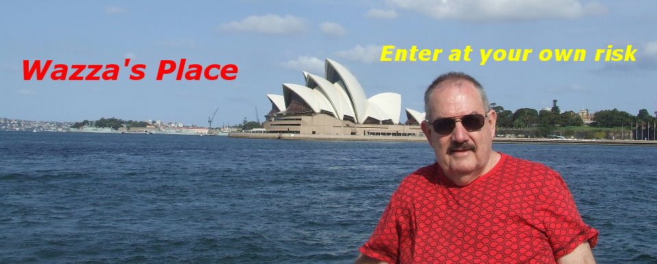
Brisbane to Perth with Holtie Part 6
We left
170km before we arrived at our next overnight stay at Wyndham.

Wyndham is situated 3440 km (2140 miles) northeast of
The town of
1885 as the major port and trading station of the
Kimberley
By 1886, the town was booming. There were six pubs, one
of which was a two-storey building. Ships brought in at least
five thousand miners who headed off to the Halls Creek
goldfields. It is known that during this boom there were
times when up to 16 vessels were moored in
 Overlooking the township of Wyndham from the Five Rivers Lookout.
However, by 1888, the gold rush at Halls Creek had ended
and the fortunes of Wyndham declined. Wyndham became
a tiny settlement serving the pastoral interests in the
Kimberley

The wharf and jetty at the Port of Wyndham.
Today, Wyndham with a population of 500 is known as the
“top town in the west” and is the northern most town and
cattle industry. The port also serves the nearby
irrigation scheme. Tourism also plays a important part of
Wyndham and four wheel driving, fishing, bush walking and
bird watching are all within easy reach.


Two views from the Five Rivers Lookout.

Sunset overlooking Wyndham and the Five Rivers.
Wyndham From the top of Mt Bastion at the Five Rivers
Lookout, you can see where the five rivers (Durack River,
Forrest River, King River, Ord River and Pentecost River)
join the Cambridge Gulf.
The views are fantastic and well worth the drive to Wyndham.

The next morning we packed the vehicle and drove the 56km
to where we started our three day journey down the
I was looking forward to this part of the journey. Peter had
travelled this road previously. This was to be the highlight of
thistrip for me. I had read about the
anxiousto see and observe all the sights that were about to
unfold before me.

The Gibb River Road was constructed in the late 1800's as a
beef road to transport cattle from surrounding stations to
Derby and Wyndham, this old stock route spans over 660kms,
linking Derby in the west and Kununurra in the east.
Originally the road went from
hence the name. The name of Gibb comes from Gibb-Maitland,
a geologist on the Brockman expedition.
Andrew Gibb Maitland was a geologist and authority on
underground water in
years. He was born on
a suburb of Perth in
The turnoff to the
from Wyndham and Kununurra is gravel right through the
660km until the last 60km into


Two views of the Gibb River Road.
The unsealed surface is improved every year, but a 4WD
or a high clearance car should be used as they can stand
the corrugations that often develop along the road. Towing
of caravans is not recommended and although we saw a
number of conventional cars on the road if they came across
any deep water crossings they could get into all sorts of trouble.
As we were going to be on the road for up to three days
we made sure to carry sufficient water and food to last
this period as there were no shops along the track. There
were also no fuel stops along the road so we had to make
sure that we had enough fuel to get us to

The Trail Fact Sheet I was given to get to Emma Gorge.
To view the sheet double click on the photo.
Our first side trip was into Emma Gorge which is only 2kms
off the
and there is a 1.6km walk to the pool and falls, which takes
about an hour. Peter had walked along this trail before so
he decided to sit and have a few beers while I ventured
down the somewhat loose and rocky terrain. This sort of
terrain is not suitable for still photography as it’s through
swamp grasslands, then onto loose rocks and over large
boulders and finally into tropical rainforest.
I took my digital cam recorder with me and shot some
great film. At the end of the track is a magnificent waterfall
and a refreshing pool that begged me to enter. After the
walk the pool was just the place to cool off. The water was
clear and was just the thing to quench your thirst and refill
my water bottle for the return trip back to the resort. Near
the side of the pool there was a thermal spring where water
seeped through a crack at the base of the cliff.
Should anybody get to this part of
missed trip to Emma Gorge should be taken.


Two Magnificent views of the waterfall and pool at Emma Gorge.
Once back at the resort we then continued on our journey.
We stopped at the
to try our luck barramundi fishing. The Pentecoste crossing
is famed for catches of barra. Rivers in this part of the
Kimberleys are known for saltwater crocodiles, so fishing
standing in the waters are a no no! We unpacked our fishing
gear and rigged up our tackle. The bait we were going to use
was some new lures we had purchased in Wyndham.
Well, we cast our lures over and over to no avail. It would
appear that the barra were not on the chew. There was a
school of bait fish leaping out of the water as if they were
being chased by larger fish, but they were in the middle of
the river. After three hours and with the sun setting, and
only having a few bites, we packed up our gear and hit the
road. It was evening when we arrived at one of the cattle
stations that provides camping areas for tourists for a small fee.

The crossing at the Pentecoste River.
The next morning we were told about some dams on the
property that could still have some barra in their trapped
waters. Here we are in the best/greatest area in the world
for catching barra and the little buggers were keeping their
distance from our fishing skills? Finally we had spent enough
time fishing (waal that’s what we thought we were doing)
and upped stakes to continue on our track towards
All the property that’s on both sides of the
is on private land. It’s all owned by various stations. All of
the
for wandering stock. While it still serves a valuable role in
getting beef cattle from stations to market, the
Road
travel this incredible landscape.
Meeting cars coming the other way can be very challenging,
as the road is extremely dusty. On straight stretches you can
see dust clouds from oncoming cars and trucks from a mile
away. It is suggested to move to the side of the road to avoid
a broken windscreen especially when a road train passes
which can have up to three trailer in tow. These can be up
to 50 metres in length.


Two road trains hurtling down the Gibb River Road.
In the
very dangerous to the environment. Fires are often caused
by lightning strikes and we saw a number of fires burning
way up in the escarpment. These fires are in such isolated
areas that nobody can reach them and they eventually burn
themselves out.

................. Hundreds of termite mounds.
Scattered throughout
Territory
of termite mounds. Termites, sometimes known as white
ants usually prefer to feed on dead plant material, generally
in the form of wood, leaf litter or soil, and are economically
significant as pests that can cause serious structural damage
to buildings, crops or plantation forests.


Termites or White Ants.......................A huge termite mound.
In some regions, notably arid tropical savannas, termites
construct extremely large and elaborate mounds which
house their colonies. These mounds can have very distinctive
forms, such as those of the compass termite which build tall
wedge-shaped mounds with the long axis oriented
approximately north-south. The column of hot air rising in the
above ground mounds helps drive air circulation currents
inside the subterranean network. Some mounds can reach
heights of 6 metres, but most species build mounds of less
than two metres height.
 Compare the size of the termite mound to the lady besides them.
We’re now more than half way down the track and as the
afternoon changes to evening, we drove onto a small siding
beside the road where we were going to pitch our tent. There
was already another vehicle that was parked, and as we set
up the tent another car arrived with a family of four. After a
meal cooked on a portable stove we settled down for a early
evening before our final day on the road.

Early the next morning we were on the road, heading towards
the next gorge we were going to visit….Bell Gorge.
In 1897 Alexander Forret’s survey party travelling from the
De Grey River to Port
Leopold of
by His Majesty in exploration". However they were unable to
find a way through the rugged ranges. In 1898 the explorer
and stockman Frank Hann managed to cross the ranges via
the pass which bears his name. Hann named Bell Creek "after
Mr. Bell of

214kms north-east of
of postcards of cascading waterfalls dropping more than 100
metres through a series of swimming pools, with breath
taking views from the cliff top over the falls.


Two views of the top and bottom pools at Bell George.
The falls are reached by a one kilometre walk from the
car park. Once you come to the top of the waterfall you
.can swim or relax in the top pool or cross, further up the
creek, to the opposite side. From there it is a reasonable
walk over the top of the hill and through the spinifex to
the bottom pool. Here is an excellent swimming hole and a
magnificent view of the waterfall and the gorge to the west.


Wazza filming at Bell Gorge.....and the bottom gorge.
This was one of the more spectacular gorges we had visited.
Where the creek flowed into the pool the water was sweet
and cool to drink. A superb place to swim and a
photographer's paradise.

In Part 7 we finish our trip down the
before our vehicle has a tremendous tyre blow out. We drive
into
our journey south to
![]()


5 comments:
Very descriptive Wazza, makes me feel like I was there with you...... Oh yeah....
I was!!!!
Warren, you are outdoing yourself. These pictures and you tales are sooooo nice!
Our Texas Hill Country and your Gibb River area look somewhat alike. But we don't have those large termite mounds. [We do have termites, Colorado has mounds.}
..
On the road again! Umm...that could make a good song!
Great post, great trip, Wazza! :)
What a fabulous story, Wazza ... I just love this huge country of ours, and feel like I was on the trip with you.
Thanks for sharing, looking forward to the next installment.
Take care, Meow
Hi Warren ~~ Another great episode of
that tremendous trip you two had.
The photos are really good and the
descrption and info very enlightening
to many of us. Thanks Warren for
sharing this adventure with us all.
Take care, Regards, Merle.
Post a Comment